
San Nicolas and Santa Teresita: Historic and Folkloric Notes about some of its Barrios
In this article, which is part of a series dedicated to historical and folkloric trivia about the barrios of Batangas, we feature the towns of San Nicolas and Santa Teresita. The information contained in this article was taken from documents required by the administration of Elpidio Quirino in 1951 from public school districts around the Philippines to replace historical documents destroyed during the war. The documents were collected in 1953 and are now archived at the National Library of the Philippines Digital Collections.
The documents for the barrios included in this article were originally filed by the National Library of the Philippines under “Taal,” since in 1953 the towns of San Nicolas and Santa Teresita were yet to be created and were still part of Taal.
Not all barrios are included. It could be that no document were submitted for those not represented; or if there were, these had been destroyed over time before they could be digitized and made available over the Internet. The geo-political scenario was also different in 1953 so it is possible that some barrios not included in the series were still part of other barrios at the time.
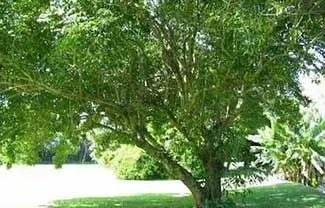
 |
| At the wharf in San Nicolas. |
San Nicolas
Abelo
Abelo used to be part of a larger barrio named Hipit, but separated when relations between its people and those living in the rest of the barrio soured. Its name, according to folklore, was taken from the abelo tree. This tree is supposed to be similar to the ayangaw tree with a “big trunk and spreading branches1.” The barrio was officially created in 1891 and given its name during a banquet held at a site where an abelo tree grew. The barrio’s first residents were the couple Victor Landicho and Ilay Tenorio. They were followed by the family of a man named Martin.
During the early years of the American colonial era, many inhabitants of the barrio converted to the “sabbadist” religion (Sabbatarian was the more correct term, the religion being the Seventh Day Adventist Church), probably due to the efforts of American missionaries. In World War II, when the Japanese learned that the Americans had already landed in Leyte, they burned houses in Abelo and neighboring villages.
Source: History and Cultural Life of the Barrio of Abelo
 |
| The abelo tree after the barrio was named was similar to the ayangaw above. Image credit: Tonji and Sylvia's Bird Sanctuary. |
Bangin
Bangin’s territory used to include Apacay, but as the barrio’s population grew, the latter separated to be a distinct barrio during the Spanish era. The origin of Bangin’s name is unknown, but it will not be farfetched to conjecture that the name was derived from a feature of the land’s topography. The date of the barrio’s founding is unknown, but among its original families was supposed to be that of one Domingo Enriquez.
During the Spanish regime, the barrio was a frequent camping place for Spanish soldiers who, however, did not harm the locals. In World War II, Japanese soldiers did not reach the barrio so Bangin was spared from the ravages of war. After the war, the Americans built roads to the barrio wide enough for jeeps to pass and taught local farmers new methods of farming.
Source: History and Cultural Life of the Barrio of Bangin
Calangay
This barrio’s name was supposed to have been taken from “a white parrot” called the kalangay. The bird is the by-now critically endangered2 Philippine or red-vented cockatoo. The name was given to the barrio supposedly by people from poblacion Taal who remembered seeing a kalangay “in every house.” The barrio was said to have existed since Taal was still located in Balangon. The area was still thickly forested then, which provided protection for families who wished to avoid attacks by sea pirates.
In the latter half of the nineteenth century, Spanish soldiers set up camp at Calangay, ostensibly to guard against the movements of the Katipunan. In 1890, a battle was fought between these soldiers and the Katipuneros, who were soundly defeated. Before leaving, the Spanish soldiers burned the houses in Calangay.
Source: History and Cultural Life of Calangay
 |
| The Philippine cockatoo, after which Calangay was named. Image credit: by PCSD (Palawan Council for Sustainable Development) ([1]) [Public domain], via Wikimedia Commons. |
Maabud
Maabud had two parts which used to be known as Maabud Ilaya and Maabud Ibaba. According to the 1953 NLP document, the barrio’s name was taken from the Tagalog word “maubod.” The document failed to explain why, but we can all conjecture that there were plenty of coconut trees from which “ubod” of the famous lumpia was harvested. The barrio was founded shortly after the cataclysmic eruption of Taal Volcano in 1754. Whereas most inhabitants of Taal relocated south to the town’s present location, there were those who preferred to move eastward and found the new barrio.
The barrio’s original inhabitants were the families of Juanso de Sagun, Alejandro Barrion, Baltazar Umandap, Nicomedes Biscocho along with other well-do-to families of the old Taal. During the Spanish era, one Colonel Tacio and a Captain Vicente recruited 300 young men presumably from the barrio and engaged Spanish forces in the battles of Pulong Anahao, Payapa, Talisay and Lipa.
Source: History and Cultural Life of Maabud
Munlawin
According to folklore, the barrio got its name when some Spaniards asked some natives what the name of the barrio was. The natives thought that the Spaniards were asking about the name of a tree in the barrio and they all said “Munlawin.” The said tree was likely the molave, alternatively called “molawin3.” Like the earliest inhabitants of Calangay, those of Munlawin settled and built a barrio to evade sea pirates.
Spanish forces also set up camp in Munlawin during the latter part of the Spanish colonial era to keep a lookout for Katipuneros. A battle was fought just outside the barrio. In World War II, all houses in the barrio were burned by the Japanese, leaving only the school standing because it was located in a secluded place.
Source: History and Cultural Life of the Barrio of Munlawin
 |
| According to folklore, Munlawin obtained its name from the molave tree (above). Image credit: Philippine Medicinal Plants. |
Pulang Bato
Supposedly, Barrio Pulang Bato was so named because there was a huge red rock wall that was between two of its sitios: Silangan and Arumahan. The barrios original settlers were fishermen and farmers. According to folklore, an old man once came to warn inhabitants of the barrio to leave because something unfortunate was about to happen. Those who heeded the old man survived. Those who did not died. This turned out to be an eruption of Taal Volcano, and while the NLP document did not say so, this was probably the eruption of 1754.
In World War II, Pulang Bato was a sanctuary for inhabitants of other barrios who were seeking to escape the savagery of the Japanese forces. Fortunately, the Japanese did not reach Pulang Bato and the barrio was spared, along with those who evacuated there.
Source: History and Cultural Life of Pulang Bato
Sinturisan
The barrio was so named because the road along it, which leads to poblacion San Nicolas, was lined with plantations of citrus trees. The name was supposedly given by Insurrectos or Philippine rebels who were meeting there but did not know how to refer to the place when they set their meetings. The place was formally given the status of barrio in 1718. In World War II, people of the barrio who were suspected by the Japanese of being members of guerrilla movements were put to death and their houses burned.
Source: History and Cultural Life of the Barrio Sinturisan
 |
| Sinturisan was so named because the roads along the barrio were lined with citrus plantations. Image credit: GardeningKnowhow.com. |
Talang
This barrio was supposed to have been named after the talang tree, which was “somewhat similar to the avocado tree.” The tree was likely the bolongeta, also known in Tagalog as the “talang gubat4.” The barrio was supposedly where the tree once grew in abundance. The barrio’s original inhabitants were the families of Juan Encarnacion and Martin de Sagun.
Source: Cultural Life of the Barrio of Talang
Santa Teresita
Irukan
Irukan was once a larger barrio until sitio Kalayaan separated from it and became a distinct barrio. The barrio’s name was supposed to have been taken from a variety of palm called the “iruk5.” The barrio folks made their livelihood from the palm such as brooms and sweets.
Source: History of the Barrio of Irukan
Mohon (Bihis and Sinipian)
The old barrio called Mohon, as populations grew, was supposed to have given birth to two barrios named Bihis and Sinipian. The name “Mohon” was from the Spanish “mojon” and signified the boundary between the towns of Taal and Bauan. The place was originally called “pinagmohonan” or “the place where the rock marker was laid down.” Meanwhile, with regards the two barrios which took its place, Bihis was named after the local-born Reverend Apolonio Bihis while Sinipian meant “a whole from which a part was taken.”
During the Philippine Revolution, many of the barrio’s men joined the revolutionary forces. Many encounters between these forces and Spanish soldiers happened in the barrio. In World War II, the barrio was sympathetic to guerrilla movements and supported these by joining up. Before the arrival of American troops, Japanese forces burned practically every house in the barrio.
Source: History and Cultural Life of the Barrio Mohon
2 “Red-vented or Philippine Cockatoo,” online at Beauty of Birds.
3 “Molave>,” online at the Philippine Medicinal Plants.
4 “Bolongeta,” online at the Philippine Medicinal Plants.
5 Unfortunately, I am unable to find any references about this palm over the Internet.