
The 29 Municipalities of Batangas Province Part I
PART I
PART I | PART II
The Province of Batangas is one of five belonging to the administrative region called Region IV-A, otherwise known as the CALABARZON. The province has a total of 34 administrative divisions. Of these, five are cities (Lipa, Batangas, Tanauan, Santo Tomas and Calaca, which are separately discussed inThe Cities of the Province of Batangas). It also has twenty-nine (29) municipalities, which will be discussed individually below.
AGONCILLO
Agoncillo is one of Batangas’ lakeside towns, located as it is on the western shores of Taal Lake. It is considered a 4thclass1municipality with a land area of 49.96 square kilometers, making it the 17thlargest of Batangas’ 29 municipalities. As of the 2020 Philippine Census, its population was placed at 39,101 individuals, making it the 9thleast populated town in Batangas. Based on these figures, Agoncillo has a population density of 782.65, making it the twelfth least densely populated town of the province. Agoncillo has a total of fourteen barrios or barangays.
ALITAGTAG
The Municipality of Alitagtag is also another of Batangas’ lakeside towns, although its town center is roughly 5.5 kilometers from the shores of Taal Lake. It has a territory equivalent to 24.79 square kilometers, making it Batangas fourth smallest in terms of land area. Its 2020 population was placed at 26,819 individuals. Given the town’s relatively small land area, it ranks 11thin terms of the province in terms of population density with 1,081.85 per square kilometer. Like Agoncillo, Alitagtag is classified as a 4thincome class municipality. It is has nineteen barrios or barangays.
 |
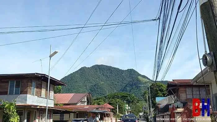
| Taal Volcano looks menacingly close seen from Boso-boso in the town of Laurel. |
BALAYAN
Balayan, one of Batangas’ largest towns in terms of territory, is also among the province’s oldest. It was among the places visited by the Spanish conquistadores Martin de Goiti and Juan de Salcedo in the Spaniards’ first venture into Luzon in the year 1570. Balayan is Batangas’ 6thlargest municipality, with a land area of 108.73 square kilometers. As of the 2020 Philippine Census, it was the province’s fourth most populous municipality with 95,913 individuals. Because of its big territory, Balayan is relatively sparsely populated, with a density per square kilometer of 882.12, ranked 14thamong 29 municipalities. Balayan, a 1stincome class2municipality, is made up of 48 barrios or barangays.
BALETE
Another lakeside town, Balete, was part of what is now the City of Lipa until 1969, when it became a separate municipality. It is nestled on the eastern shores of Taal Lake, with a land area of just 25 square kilometers. This makes Balete the fifth smallest town of Batangas in terms of land area. Its 2020 population was placed at 24,055 individuals, and given its small territory, it ranks 13thamong Batangas’ most densely populated with 962.2 per square kilometer. Balete is a 5thincome class3made up of 13 barrios or barangays.
BAUAN
The municipality of Bauan also used to be a lakeside town of Batangas, but the perilous eruptions of Taal Volcano down the centuries convinced its citizens to relocate away from the lake and onto the shores of Batangas Bay, where it is presently located. It is a relatively small town with a total land area of just 53.31 square kilometers. Nonetheless, it is a progressive 1stincome class municipality with a 2020 population of 90,819 individuals. Given its relatively small territory, Bauan is the third most densely populated town in Batangas with 1,703.6 per square kilometer. There are, in all, 40 barrios or barangays in Bauan.
CALATAGAN
The historic town of Calatagan, known not just for its beach resorts but also for archaeological sites, is on the shores of the West Philippine Sea, just round the bend from the Bay of Balayan. It is a large town with a total territory of 101.5 square kilometers. As of the 2020 Philippine Census, its population was at 58,719 individuals. Because of its wide territory, Calatagan is not very densely populated with only 578.51 per square kilometer, seventh least in the entire province. Calatagan, considered a 2ndincome class4municipality, is made up of 32 barrios or barangays.
CUENCA
Like Alitagtag, Cuenca also has part of its territory on the shores of Taal Lake, although its main population center is more inland and shielded by eruptions of Taal Volcano by Mount Maculot. Cuenca has a land area of 58.18 square kilometers including the mountain, on which some of the fiercest battles of the Second World War were fought. Its 2020 population was pegged at 36,235 individuals which makes the town the 20thmost densely populated municipality of Batangas with 622.81 per square kilometer. Cuenca used to be part of San Jose until it was officially separated in 1876. Presently, it is a 4thincome class municipality made up of 21 barrios or barangays.
IBAAN
Ibaan is a landlocked municipality of Batangas with no access to the lake or Batangas Bay, surrounded as it is by the towns of San Jose to its northeast, Taysan to its southeast, and Rosario to the east; and the cities of Lipa and Batangas to its northeast and southeast, respectively. It is a 2ndincome class municipality with a total land area of 68.99, twelfth largest in the province. Its 2020 population was placed at 58,507, giving it a population density of 848.05 per square kilometer. Ibaan is made up of 26 barrios or barangays.
LAUREL
Laurel is also a lakeside town, with Agoncillo the closest in terms of physical distance to Taal Volcano. Founded in 1969 when it separated from Talisay, in fact Laurel, like Talisay, Agoncillo and San Nicolas, was a part of Taal during the Spanish colonial era. Laurel’s total land area is 71.29 square kilometers, 11thlargest in Batangas. Its population as per the 2020 Philippine Census was placed at 43,210, giving it a relatively sparse density of 606.12 per square kilometer. Laurel is classified as a 3rdincome class5municipality and it is made up of twelve barrios or barangays.
 |
| Mount Maculot in Cuenca seen from Barrio Labac. |
LEMERY
Lemery is a municipality of Batangas Province on the shores of Balayan Bay. It used to be part of Taal, from which it is presently separated by the famous Pansipit River. Lemery’s land area is actually much larger than Taal, the town from which it separated, with a total of 109.8 square kilometers. This makes Lemery the fifth largest town in Batangas in terms of territory. Its 2020 population was placed at 93,186 individuals, but because of its large territory, the town is relatively sparsely populated with just 848.69 per square kilometer. Lemery is considered a first income class municipality and it is made up of 46 barrios or barangays.
LIAN
The western Batangas town of Lian, known for its sprawling sugarcane plantations, if judged by its town center, may seem small. However, its total land area is actually 76.8 square kilometers, 10thlargest among the municipalities of Batangas. Lian’s population as of the 2020 Philippine Census was placed at 56,280 individuals. Because of the town’s relatively agrarian nature, this population is also considerably spaced out, the town having a relatively low density of 732.81 per square kilometer. Lian, which is made up of 19 barrios or barangays, is classified as a 3rdincome class municipality.
LOBO
Lobo, famous for the Malabrigo Light house and its many seaside resorts, is Batangas’ fourth largest municipality in terms of land area with a total of 175.03 square kilometers. However, it is sparsely populated with just 40,736 as per the 2020 Philippine Census, making the town the province’s least densely populated geo-political unit with just 232.74 per square kilometer. Lobo is classified as a 3rdincome class municipality and is made up of 26 barrios or barangays.
MABINI
Mabini, which used to be part of Taal, has territory on the shores of both Batangas and Balayan Bays. It goes without saying that the municipality is named after the Philippine hero Apolinario Mabini. The town has a total land area of 44,47 square kilometers, eighteenth in Batangas. Its 2020 population was placed at 50,858, making it among the top ten most densely populated towns of Batangas with 1,143.65 per square kilometer. Also known for its beach resorts and its dive sites, Mabini is classified as a first income class municipality. It is made up of 34 barrios or barangays.
MALVAR
The municipality of Malvar used to be part of Lipa during the Spanish era until it separated in 1919. It used to be known for Lipa’s coffee plantations as well as, during the early years of the American colonial period, being the hideout for brigands known as “tulisanes.” One of Batangas’ smaller towns, it has a total land area of a mere 33 square kilometers. Its population was placed at 64,379 after the 2020 Philippine Census, and given its small land area, has the province’s second highest population density with 1,950.88 per square kilometer. Malvar is classified as a second income class municipality and is made up of 15 barrios or barangays.
MATAASNAKAHOY
Like Malvar, the town of Mataasnakahoy also used to be part of Lipa. It separated officially from what is now Lipa City in 1932. The town has a total land area of 19.66 square kilometers, making it the second smallest in Batangas. Its 2020 population was placed at 30,621 individuals, giving this small town a population density of 1,557.53 per square kilometer. This figure makes Mataasnakahoy the fifth most densely populated town in Batangas. Mataasnakahoy is classified as a 4thincome class municipality and is made up of 16 barrios or barangays.
PART I | PART II
Notes and references:
1That, is, a municipality that generates an average annual income of from ₱25M to ₱35M.2A first income class Philippine municipality averages an annual income of at least 55M pesos.
3A fifth income class Philippine municipality averages an annual income of 15M to 25M pesos.
4A second income class Philippine municipality averages an annual income of 45M to 55M pesos.
5A third income class Philippine municipality averages an annual income of from 35M to 45M pesos.