
Aerial Photographs of Taal Lake and Taal Volcano 1939
The photograph below was taken on 27 December 1939 by an aircraft that flew from Nichols Airfield (present-day Villamor Airbase). It was originally captioned “Taal Volcano and Lake Taal, Batangas, Luzon Island, P.I. (for Philippine Islands).”
Meanwhile, below is a photograph likely taken from the same flight that took the picture above (the date taken was not indicated). It is a closer shot of the main volcano island crater and was originally captioned “Taal Volcano and Taal Island (a misnomer because there is no such thing as a Taal Island), Luzon Island, P.I. (for Philippine Islands).”
Both photographs were downloaded from the United States National Archives and colorized courtesy of Algorithmia.
Notes and references:
Image credit: United States National Archives. Colorization courtesy of Algorithmia.
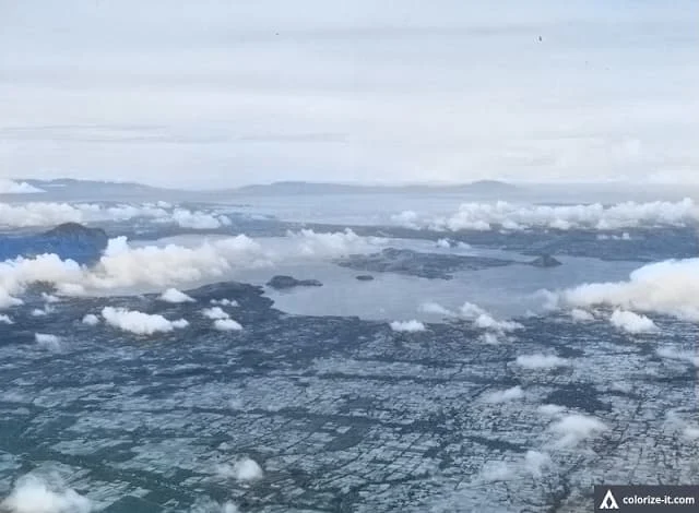 |
| Photo of Taal Lake and Taal Volcano, taken 1939. Image source: United States National Archives. |
 |
| Photo of the Taal Volcano main island crater taken in 1939. Image source: United States National Archives. |
Both photographs were downloaded from the United States National Archives and colorized courtesy of Algorithmia.
Notes and references:
Image credit: United States National Archives. Colorization courtesy of Algorithmia.