
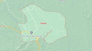
Map of Taysan, Batangas
The town of Taysan is a 2nd income class municipality of the Province of Batangas, with a total land area of 9,362 hectares and a population of 40,146 as per the 2020 Philippine Census. It used to be a barrio of the neighboring town of Rosario. The town has 20 barangays and is part of Batangas’ 4th legislative district.
Late in the Spanish era, Taysan was already a municipality but reverted to the status of a barrio called Mercedes during the American era. It finally became a town again in 1919. Taysan can be reached by road from Manila via the Southern Tagalog Arterial Road through Ibaan and Rosario.
To see an interactive map of Taysan, please click on the static image below. You will be redirected to Google Maps using a new browser tab.