
The Towns of Batangas that used to be Part of other Towns in the Province
Batangas as we know it in the present day had vastly different geopolitical subdivisions at the dawn of the Spanish colonial era, with only a few towns or pueblos as they were called. As the population of these towns grew and settlers branched out to populate other localities, new barrios were created which would, over time, become themselves new municipalities. In fact, as relatively recently as the 1960s, the geopolitical subdivision was still being rearranged. This article attempts to show readers how some towns of Batangas branched out from their mother towns to become municipalities in their own right.
[Note to the reader: I am unable to find documentation that states that the town of Lobo used to belong to a previous mother town. The area of what is presently Lobo used to be populated by settlers who would one day found Rosario, so it may well be that a new town developed independently after these settlers moved northwards to avoid persistent Moro raids.]
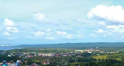 |
| Lemery seen from the tower of the St. Martin de Tours Basilica in Taal. |
Agoncillo
The lakeside town of Agoncillo used to be part of neighboring Lemery until it was formally separated as the Municipality of Pansipit in 1948. A year later, the name of the new municipality was changed to Agoncillo in honor of the Filipino statesman Don Felipe Agoncillo.1
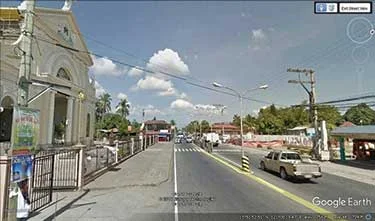
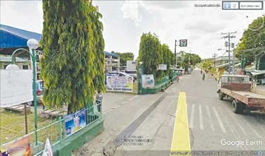
 |
| Agoncillo Municipal Hall. Image credit: Google Street View. |
Alitagtag
The town of Alitagtag used to be part of Bauan. In 1908, local civic leaders started conducting meetings that would pave the way for the move away from Bauan. On 11 July 1909, by way of an executive order issued by the American colonial government, Alitagtag became a town of its own.2
 |
| Poblacion Alitagtag. Image credit: Google Street View. |
Balete
The lakeside town of Balete used to be a barrio of Lipa City until it became a distinct municipality by an act of congress on 21 June 1969. Balete was where settlers of old Lipa migrated to escape the wrath of Taal Volcano during its cataclysmic eruption in 1754.3
 |
| Nuestra Señora de la Paz Parish Church, Balete. Image credit: Google Street View. |
Calaca
The town of Calaca used to be a barrio of Balayan until it was officially established as a separate municipality on 10 May 1835. Rufino Punungbayan, Cayetano Buhay, Januario Punungbayan, Valentin Capacia, Juan Sanggalang and Diego Inumerable were among those who pushed for its establishment as a distinct town.4
 |
| Poblacion Calaca. Image credit: Google Street View. |
Calatagan
The town of Calatagan in western Batangas, acquired by Don Domingo Roxas from the Spanish crown in 1829 and called Hacienda de Calatagan, used to be part of Balayan until it became a separate municipality in 1912.5
 |
| Poblacion Calatagan. Image credit: Google Street View. |
Cuenca
The town of Cuenca at the foot of Mt. Maculot used to be under the town of San Jose. In 1875, the civic-minded leaders of the barrio submitted a petition to the governor asking for the place to be declared a separate town. The petition was granted on 7 November 1876, and the governor named the new town Cuenca after his hometown in Spain.6
 |
| Poblacion Cuenca. Image credit: Google Street View. |
Ibaan
The town of Ibaan was once a barrio that was part of Batangas town, now Batangas City. Ibaan became a municipality of its own distinct from Batangas Town in 1832.7
 |
| Poblacion Ibaan. Image credit: Google Street View. |
Laurel
The lakeside town of Laurel used to be a barrio called Bugain which was formerly part of Talisay. It formally separated from Talisay by virtue of Republic Act No. 5689 dated 21 June 1969.8
 |
| Poblacion Laurel. Image credit: Google Street View. |
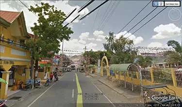
Lemery
Originally called “Punta” and settled by immigrants from Taal, Mindoro and Cavite, Lemery used to be a barrio of Taal until 1862, when it became a separate municipality named after Captain Roberto Lemery.9
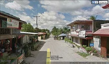
 |
| Poblacion Lemery. Image credit: Google Street View. |
Lian
The ancient western Batangas town of Lian, which used to be a trading center with the Chinese prior to the arrival of the Spaniards, was originally a barrio of Nasugbu. Its first and distinct municipal government was organized in 1914.10
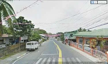
 |
| Poblacion Lian. Image credit: Google Street View. |
Mabini
The town of Mabini, lately very much in the public consciousness because of a rash of earthquakes, used to be part of the pueblo established by the Spaniards called Bauan. It became a separate municipality on the first day of 1918.11
 |
| Poblacion Mabini. Image credit: Google Street View. |
Malvar
The town of Malvar between Lipa City and Tanauan City used to be a village called Luta that was part of the then-town of Lipa. On 16 December 1918, through the efforts of Teodoro M. Kalaw, Malvar was proclaimed a separate town by the American Governor Charles Yester.12
 |
| Poblacion Malvar. Image credit: Google Street View. |
MataasnaKahoy
MataasnaKahoy used to be a barangay or a village that was part of the then-town of Lipa. It was recognized as a municipality distinct from Lipa on 1 January 1932 by way of an Executive Order issued by the American Governor George C. Butte.13
 |
| Poblacion MataasnaKahoy. Image credit: Google Street View. |
Nasugbu
Nasugbu, a favorite tourist destination on the western edge of Batangas, was part of the pueblo (a Spanish-era Christian settlement or geopolitical unit) founded in 1578 as Balayan. It became a separate municipality in 1899 and is the largest town in Batangas in terms of land area. It is also the second most populous town of the province after Santo Tomas.14
 |
| Poblacion Nasugbu. Image credit: Google Street View. |
Padre Garcia
Padre Garcia was where Rosario used to be located until it was razed almost to the ground in World War II. It then used to be a barrio of Rosario called Lumang Bayan or Sambat, until it became a separate municipality in 1949 by way of an Executive order issued by then President Elpidio Quirino.15
 |
| Poblacion Padre Garcia. Image credit: Google Street View. |
San Jose
The town of San Jose began life as a barrio of the municipality of Bauan called Malaquing Tubig. Leaders of the barrio petitioned the Spanish colonial government for the creation of a separate pueblo. On 26 April 1765, the petition granted and the new pueblo was called San Jose de Malaquing Tubig.16
 |
| Poblacion San Jose. Image credit: Google Street View. |
San Juan
The beach resort town of Batangas on the eastern fringe of the province began as a small village called Bolbok or Nabulbok and was a part of the town of Rosario. It formally separated from Rosario when it obtained a municipal charter in 1898. San Juan is the second largest municipality in Batangas in terms of land area.17
 |
| Poblacion San Juan. Image credit: Google Street View. |
San Luis
The town of San Luis used to be a barangay called Balibago which was part of the municipality of Taal. It formally separated from Taal on 25 August 1861 and was renamed San Luis because the day of its formal separation fell on the feast of St. Louis.18
 |
| Poblacion San Luis. Image credit: Google Street View. |
San Nicolas
San Nicolas used to be the site of the old pueblo of Taal until residents were forced inland by the 1754 eruption of Taal Volcano. San Nicolas continued to be a barrio of Taal until it became a separate municipality in 1955. The town is the smallest inatangas in terms of land area.19
 |
| Poblacion San Nicolas. Image credit: Google Street View. |
San Pascual
The town of San Pascual between Batangas City and Bauan used to be a barrio of the latter called Lagnas. It separated from Bauan in 1969 to become an independent municipality.20
 |
| Poblacion San Pascual. Image credit: Google Street View. |
Santa Teresita
Santa Teresita is a municipality created by way of an executive order issued on 29 December 1961 by then-President Carlos P. Garcia. The new municipality was created with territory made up of barangays that were formerly part of Taal, San Luis and San Nicolas.21
 |
| Poblacion Santa Teresita. Image credit: Google Street View. |
Talisay
The lakeshore town of Talisay at the foot of the mountain used to be a barrio of Tanauan when the latter was still a lakeshore town in what is now Ambulong. When Tanauan moved away from the lake, jurisdiction over Talisay transferred to Taal, until it became a separate municipality in 1869.22
 |
| Poblacion Talisay. Image credit: Google Street View. |
Taysan
The small municipality of Taysan used to be a barrio called San Mercedes which was part of Rosario until it separated from the mother town in 1919. The great Lipeño Teodoro Kalaw was instrumental in having a bill passed in congress to create Taysan as a separate town.23
 |
| Poblacion Taysan. Image credit: Google Street View. |
Tingloy
Founded in 1890, the archipelagic town of Tingloy, which consists of Maricaban and Caban islands along with other tiny islets, was originally part of San Luis in 1917. It then became part of Bauan, Mabini and Bauan again until it became a separate municipality in 1955.24
 |
| The island municipality of Tingloy. Image credit: Google Earth. |
Tuy
Tuy was another barrio of Balayan until it became a municipality of its own on 12 August 1866. The name Tuy was given by former Batangas Governor Don Salvador Ellio to remind him of his birthplace, the town of Tui in Galicia, Spain.25
 |
| Poblacion Tuy. Image credit: Google Street View. |
2 “Alitagtag, Batangas History,” online at Wow Batangas.
3 “Balete, Batangas History,” online at Wow Batangas.
4 “History,” online at Municipality of Calaca.
5 “History,” online at Calatagan official web site.
6 “Cuenca, Batangas History,” online at Wow Batangas.
7 “Ibaan, Batangas History,” online at Wow Batangas.
8 “History,” online at Laurel, Batangas web site.
9 “Lemery, Batangas,” Wikipedia.
10 “Lian, Batangas Info,” online at the Lian, Batangas official web site.
11 “Mabini, Batangas,” Wikipedia.
12 “History,” online at the Malvar official web site.
13 “MataasnaKahoy Executive Summary,” online at the Commission on Audit web site.
14 “Nasugbu History,” online at Nasugbu, Batangas official web site.
15 “Padre Garcia, Batangas,” Wikipedia.
16 “San Jose, Batangas,” Wikipedia.
17 “A Glimpse of History,” online at the San Juan Local Government web site.
18 “San Luis, Batangas History,” online at Wow Batangas.
19 “San Nicolas, Batangas,” Wikipedia.
20 “San Pascual, Batangas,” Wikipedia.
21 “Santa Teresita, Batangas History,” online at Wow Batangas.
22 “History,” online at the Talisay official web site.
23 “Taysan, Batangas History,” online at Wow Batangas.
24 “Tingloy, Batangas,” Wikipedia.
25 “Tuy, Batangas,” Wikipedia.