
Map of Alitagtag, Batangas
Alitagtag is a fourth class municipality of the Province of Batangas. It is the fourth smallest town in Batangas in terms of size with just less than 2,500 hectares of territory. Its population as per the 2020 Philippine Census was 26,819. Alitagtag used to be part of the Municipality of Bauan, which incidentally started life as a missionary pueblo close to Taal Lake and the modern day location of Alitagtag.
There are 19 barangays in all in the town of Alitagtag, which belongs to the 3rd legislative district of Batangas. The town is famous for its float-making industry. In fact, the highway that cuts through the town is frequently lined with these floats as they await being commissioned.
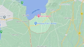
To see an interactive map of Alitagtag, please click on the static image below. You will be redirected to Google Maps using a new browser tab.
There are 19 barangays in all in the town of Alitagtag, which belongs to the 3rd legislative district of Batangas. The town is famous for its float-making industry. In fact, the highway that cuts through the town is frequently lined with these floats as they await being commissioned.
To see an interactive map of Alitagtag, please click on the static image below. You will be redirected to Google Maps using a new browser tab.