
Map of Nasugbu, Batangas
The seaside town of Nasugbu, where American forces made a landing of troops in January of 1945 as a prelude to the liberation of Batangas from Japanese occupation, is presently a 1st class income town with a total land area of 27,851, second only to Batangas City in the province. According to the 2020 Philippine Census, its population that year was 136,524, fifth highest in Batangas.
The town has 43 barangays and is included in the 1st legislative district of Batangas. Nasugbu is known for its excellent beaches and resorts. It can be reached by road from Manila via Tagaytay or via Ternate through the Kaybiang Tunnel.
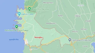
To see an interactive map of Nasugbu, please click on the static image below. You will be redirected to Google Maps using a new browser tab.
The town has 43 barangays and is included in the 1st legislative district of Batangas. Nasugbu is known for its excellent beaches and resorts. It can be reached by road from Manila via Tagaytay or via Ternate through the Kaybiang Tunnel.
To see an interactive map of Nasugbu, please click on the static image below. You will be redirected to Google Maps using a new browser tab.