
Aerial Photograph of Batangas City 1923
The photograph below was downloaded from the United States National Archives with the original caption of “Area 18. Philippine Islands. Luzon Island. Batangas Province. Batangas.” An annotation on the photograph says that it was taken “about 1923.” At the lower left of the picture appears to be a river curving at the corner.
The photo was but one of many aerial surveys taken by the American colonial government of various localities in the Philippines. Planes flying from what was then known as Nichols Airfield (now Villamor Airbase) were often utilized.
For clarity, the original picture was processed using graphic software to lighten the dark areas and sharpen the image overall. It has been colorized courtesy of Algorithmia.
Notes and references:
Image credit: United States National Archives. Colorized courtesy of Algorithmia.
The photo was but one of many aerial surveys taken by the American colonial government of various localities in the Philippines. Planes flying from what was then known as Nichols Airfield (now Villamor Airbase) were often utilized.
For clarity, the original picture was processed using graphic software to lighten the dark areas and sharpen the image overall. It has been colorized courtesy of Algorithmia.
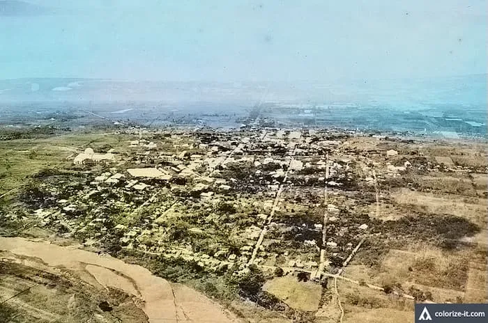 |
| Aerial photograph of Batangas City taken circa 1923. Image source: United States National Archives. |
Notes and references:
Image credit: United States National Archives. Colorized courtesy of Algorithmia.