
Map of San Juan, Batangas
The town of San Juan (formerly San Juan de Bocboc) is the third largest geopolitical subdivision of the Province of Batangas with a total land area amounting to 27,340 hectares. The town has a total population as per the 2020 Philippine Census of 114,068, distributed among 42 barangays. It is considered a 1st income class municipality which is part of the 4th legislative district of Batangas.
Apart from its excellent beaches and resorts, San Juan is also known for its baroque architecture church and an important archeological dig site. The town can be reached by road from Manila via the Southern Tagalog Arterial Road through Ibaan and Padre Garcia.
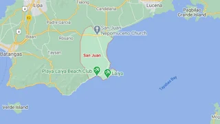
To see an interactive map of San Juan, please click on the static image below. You will be redirected to Google Maps using a new browser tab.
Apart from its excellent beaches and resorts, San Juan is also known for its baroque architecture church and an important archeological dig site. The town can be reached by road from Manila via the Southern Tagalog Arterial Road through Ibaan and Padre Garcia.
To see an interactive map of San Juan, please click on the static image below. You will be redirected to Google Maps using a new browser tab.