
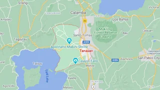
Map of Tanauan City, Batangas
The City of Tanauan is the Province of Batangas’ third city after Lipa and Batangas City, having been declared such as recently as 2001. Despite being the one of the newest in the province, Tanauan is progressive and frequently ranks high in surveys conducted by the national competitive index council.
It has a land area of 10,716 hectares and a 2020 population of 193,936 inhabitants, fourth highest in Batangas behind Lipa, Batangas City and Sto. Tomas City.
Tanauan is a first-class component city with 48 barangays. It serves as a gateway to the Municipality of Talisay and the beauteous Taal Lake, the shores of which used to be where the pueblos of Sala and Tanauan, from which the modern city would subsequently arise, used to be located. The City of Tanauan can be reached from Manila directly via the Southern Tagalog Arterial Road.
To see an interactive map of Tanauan City, please click on the static image below. You will be redirected to Google Maps using a new browser tab.