
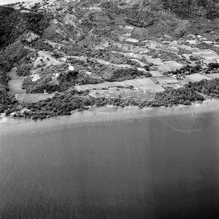
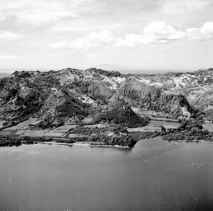
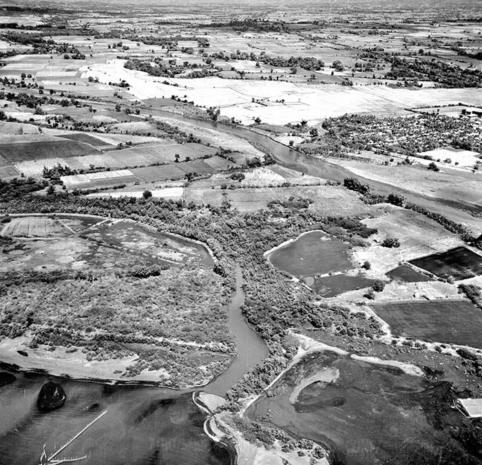
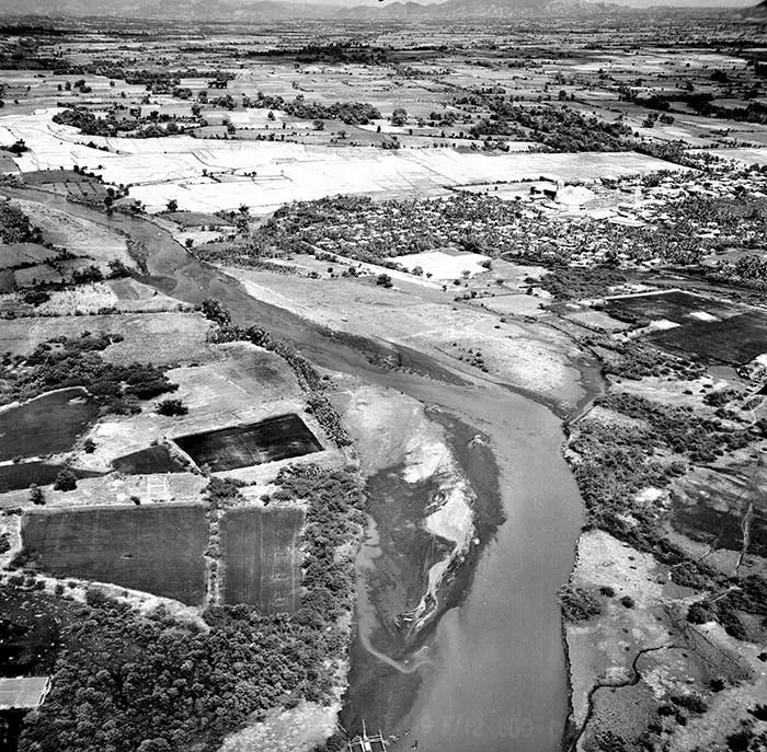
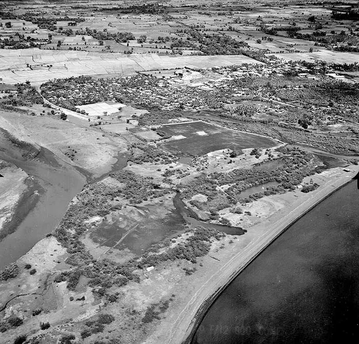
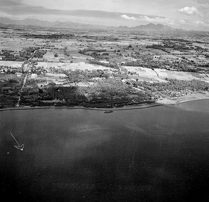
Aerial Photographs of Batangas January 1945, Possibly Military Reconnaissance
In this page are selected aerial photographs taken of the province of Batangas in January 1945 and recently released (2023) by the United States National Archives and Records Administration (NARA) through its online digital library.
Apart from providing the date when the pictures were taken, the National Archives provides no other information about each of the pictures. However, since the stated date when these were captured, i.e. 9 January 1945, was coincidentally the landing of Allied Forces, led by the United States Army Sixth Army, on the beaches at Lingayen, then it is safe to assume that these aerial photographs below were likely taken by American reconnaissance planes to collect information that would be used for the Nasugbu Landing of the United States Eighth Army.
Said landing, which is extensively covered in this web site, would eventually take place on the 31st of January 1945. While the National Archives did not provide locations for each of the individual photographs, visible landmarks seem to point at the pictures having been taken at Balayan Bay and along the coasts of Nasugbu.
The pictures shown below are optimized and are, therefore, in lower resolution. However, for those who may wish to avail of higher resolution photographs, particularly for educational purposes, download links from Google Drive are provided below each photograph. While these pictures are in the public domain, users who wish to make these photographs available online are nonetheless encouraged to attribute them to the United States National Archives and Records Administration.

Click for higher resolution version from Google Drive.
Click for higher resolution version from Google Drive.
Click for higher resolution version from Google Drive.

Click for higher resolution version from Google Drive.

Click for higher resolution version from Google Drive.

Click for higher resolution version from Google Drive.
Click for higher resolution version from Google Drive.
Click for higher resolution version from Google Drive.
Click for higher resolution version from Google Drive.

Click for higher resolution version from Google Drive.
Click for higher resolution version from Google Drive.

Click for higher resolution version from Google Drive.