
Map of Agoncillo, Batangas
The lakeside town of Agoncillo is among the Province of Batangas’ smaller municipalities, with a land area of just under 5,000 hectares and a 2020 population of just over 39,101. This town used to be part of Lemery, and formally separated in 1949 as per executive order from President Elpidio Quirino. It is currently categorized as a 4th class municipality.
Agoncillo has 21 barangays in all and is part of the 3rd legislative district of Batangas. It can be reached from Manila via STAR through Lipa City, Cuenca, Alitagtag, Santa Teresita, Taal and Lemery; or via Tagaytay through Payapa Road.
To see an interactive map of Agoncillo, please click on the static image below. You will be redirected to Google Maps using a new browser tab.
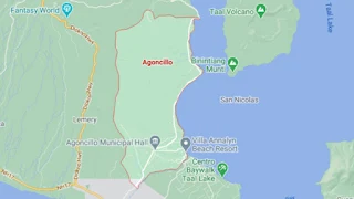