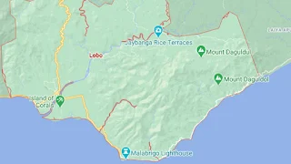
Map of Lobo, Batangas
The seaside town of Lobo in the Province of Batangas was, according to folklore, the original site of what in the present day is the other Batangas town of Rosario. It is famous for its resorts as well as the Spanish-era lighthouse of Malabrigo. In the present day, Lobo is a 3rd income class town with a total land area of 17,503 hectares and a 2020 population of 40,736. It is part of the Province of Batangas’ 2nd legislative district.
Known as the “Atis Capital” of the Philippines for its production of the sugar apple, Lobo can be reached by road from Manila via the Southern Tagalog Arterial Road through Batangas City.
To see an interactive map of the town of Lobo, please click on the static image below. You will be redirected to Google Maps in a new browser tab.