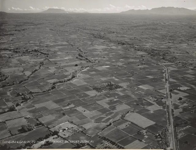
Aerial Photograph of Batangas City 1935
 |
| Aerial photograph of Batangas Town. Image source: United States National Archive. |
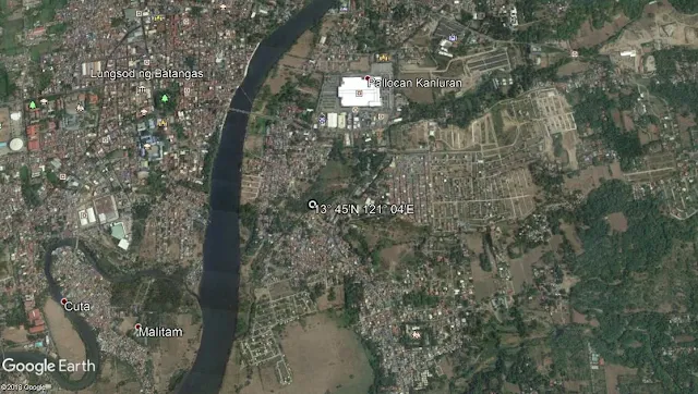
The locations approximate coordinates given are 13° 45'N 121° 04'E, which means that if these are accurate, the picture was taken while the aircraft was in over the vicinity of the Pallocan area of what is present-day Batangas City.
Below is the satellite photo of the very same coordinates as rendered by Google Earth.
 |
| Almost dead center, the coordinates given in the historic aerial photograph above. Image source: Google Earth. |
Notes and references:
Image credit: United States National Archives and Google Earth.
