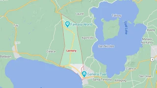
Map of Lemery, Batangas
The seaside town of Lemery along Balayan Bay began life as a barrio of the Municipality of Taal, and is named after a member of the Spanish Guardia Civil who was assigned to the town in the 19th century. In the present day, it is a 1st income class town which is part of the Province of Batangas’ 1st legislative district. In all, Lemery has 46 barangays distributed in a total land area of 10,980 hectares. Its 2020 population was 93,186.
Lemery can be reached by road from Manila via the Southern Tagalog Arterial Road through Lipa City, Cuenca, Alitagtag, Santa Teresita and Taal; or via Tagaytay via the Payapa Road.
To get to an interactive map of Lemery, please click on the static image below. You will be redirected to Google Maps using a new browser tab.