
[MAP] Batangas Pre-War Road Map
The map has been digitally extracted from the files of the guerrilla outfit GHQ Batangas Force Fil-American Irregular Troops (FAIT). This was but one of the many guerrilla units operating in Batangas affiliated with the FAIT, organized by the retired United States Army Colonel Hugh Straughn, who would, however, be captured and executed by the Japanese.
In the map, thick red lines represent first class roads. Parallel thin red lines, meanwhile, depict second class roads. Because the map contained in the guerrilla files is incomplete, Batangas History, Culture and Folklore cannot state what date exactly this map was created. However, there is every likelihood that it was published just before the outbreak of war.
Here is the road map of Batangas and neighboring provinces.
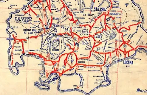 |
| A pre-war road map of Batangas and neighboring provinces. |
Click here to view/download a higher resolution of the map above.
Notes and references:
1 “GHQ, Batangas Force, FAIT,” File 110-3, online at PVAO.