
Antique Map Chronicles 18th Century Eruptions of Taal Volcano
At Google Arts & Culture 1 , there is a feature story on an antique map that chronicles the series of eruptions of Taal Volcano in the...

At Google Arts & Culture 1 , there is a feature story on an antique map that chronicles the series of eruptions of Taal Volcano in the...
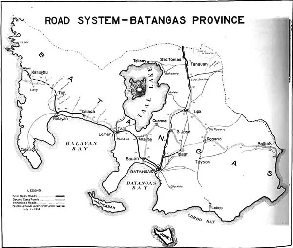
The turn of the 20 th century in Batangas saw the new American colonial government, through the Bureau of Public Works, execute an ambiti...
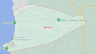
The municipality of San Luis is a 4 th income class town of the Province of Batangas. It used to be part of Taal but formally from its m...
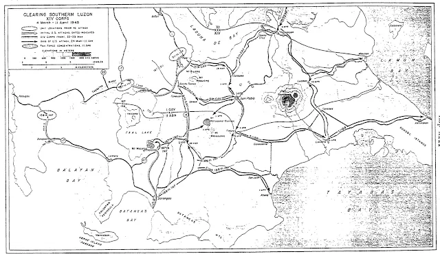
The map below shows the movement of United States Army troops in Batangas in early 1945. Its title is “Clearing Southern Luzon XIV Corps.”...

The town of Mataasnakahoy is the Province of Batangas’ 3 rd smallest town, with a land area of just 2,210 hectares. Its 2020 population ...

Below is a map of the towns of Lemery and Taal in Batangas Province created in 1944 by the United States Army Map Service. It has been do...

Below is a map of the Province of Batangas originally contained in the 1920 publication “Census of the Philippine Islands taken under the di...

The map below shows the street plan (including street names) of the then–town of Lipa in Batangas in the year 1944. The map was originally ...

Below is a map of the then–town of Batangas generated by the United States Army Map Service in 1944. It has been downloaded from the Digita...

Below is a sketched map of the Taal Land and Volcano along with the surrounding areas, extracted from the 1911 publication “The Eruption of ...